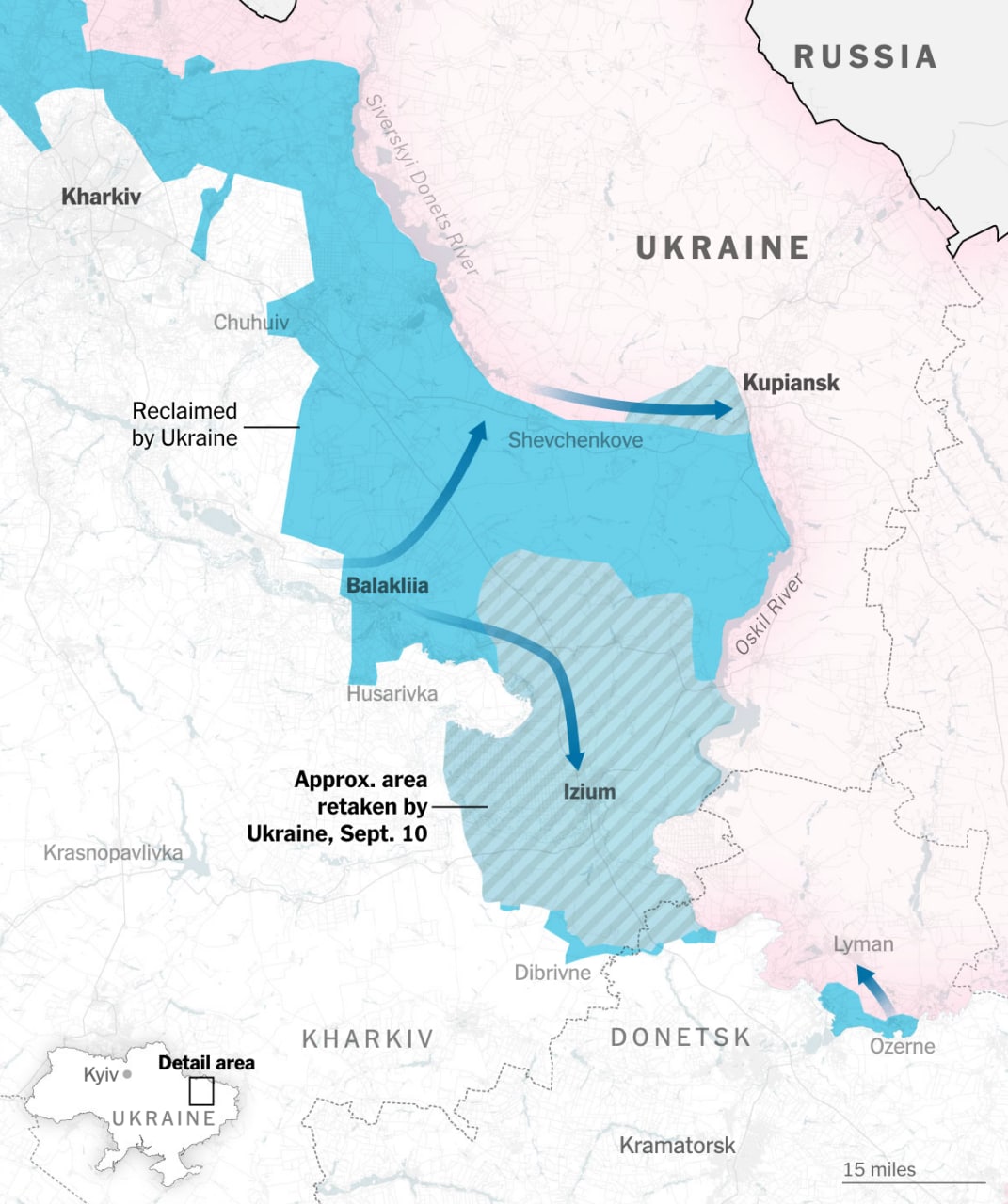
A map has been published showing the approximate advance of Ukrainian troops in the Kharkiv direction as of September 10. The map is published by The New York Times.
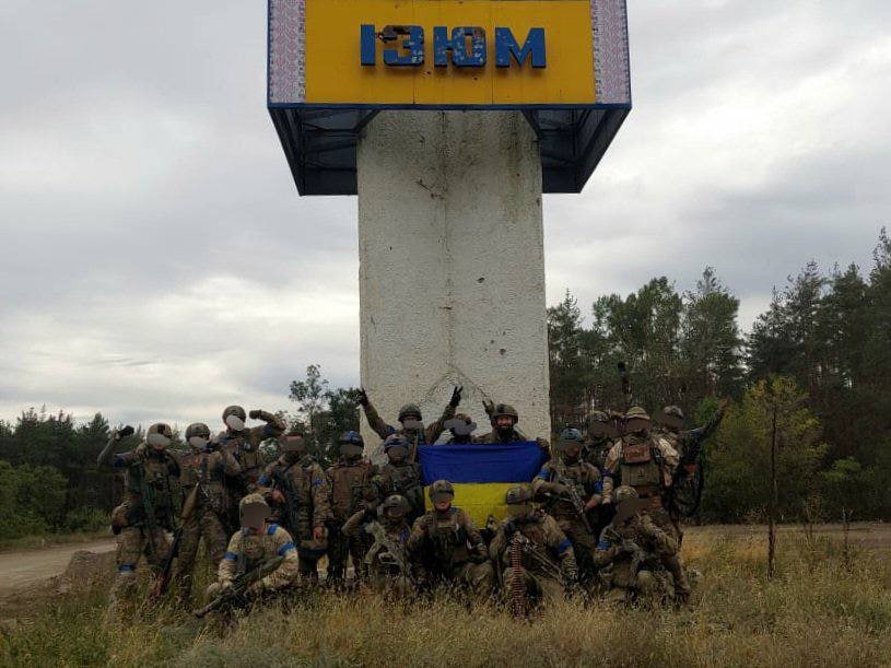
According to the map posted by the publication, Izyum returned under the control of the Armed Forces of Ukraine, and the Armed Forces of Ukraine also reached Kupyansk and the Oskol River. From the bridgehead in the village of Ozernoye, an attack is underway on the southern flank of the Russian group in the Liman area.

The Insider wrote that during the retreat of the RF Armed Forces, equipment is abandoned . A video with destroyed equipment in the Kharkiv direction appeared on the network. So, videos with T-72B3 tanks and MT-LB combat vehicle were published on Twitter.
As of 10:00 p.m. on September 10, the Armed Forces of Ukraine probably reached the southern outskirts of the city of Volchansk. Also, the Ukrainian flag was placed on Mount Kremenets, one of the dominant heights in the vicinity of the city of Izyum. Before that, the Armed Forces occupied the western part of Kupyansk. The head of the Ukrainian Luhansk OVA, Serhiy Gaidai, said that local residents saw servicemen of the Armed Forces of Ukraine on the outskirts of Lysichansk, and the Ukrainian flag was raised in the city of Kremennaya. There is no independent confirmation of this information.
Sources of The Insider in the power structures of Ukraine reported that the operation to liberate Izyum and Kupyansk is considered by the Armed Forces of Ukraine as a rehearsal in preparation for an attack on Kherson.
Read more online The Insider “Kupyansk, Izyum, Liman. What happens with the offensive of the Armed Forces of Ukraine in the Kharkov direction.