Old geographical maps without marking the territories annexed and occupied by the Russian Federation, which the country considers its own, will not be recognized as extremist materials and will not be subject to the relevant legislation. The information was clarified by the chairman of the State Duma Committee on Security Vasily Piskarev in his Telegram channel.
“All questions will be settled by the second reading, including the fact that historical or old maps containing books, manuals, etc., should not and cannot fall under the law.”
He explained that the bill refers to maps that "deny that our country belongs to certain territories" and distributed "with the intent and conscious purpose of calling into question the territorial integrity of the Russian Federation." At the same time, Piskarev wrote that the bill was adopted in the first reading on December 20, 2022 and is only being prepared for the second reading. However, the day before, on May 25, it was reported that the State Duma adopted in the second and third readings a law on fines or arrest up to 15 days for distributing maps or images that "dispute the territorial integrity of the Russian Federation."
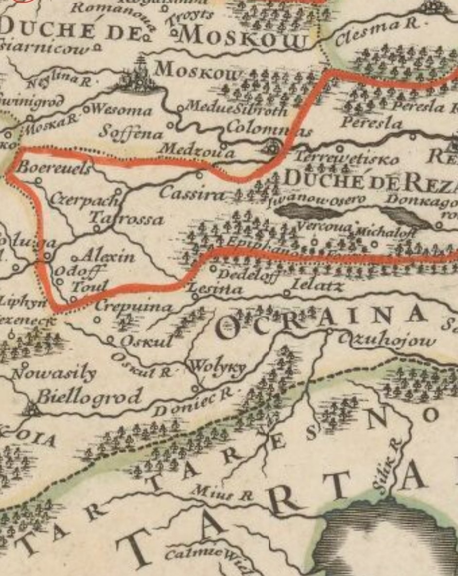
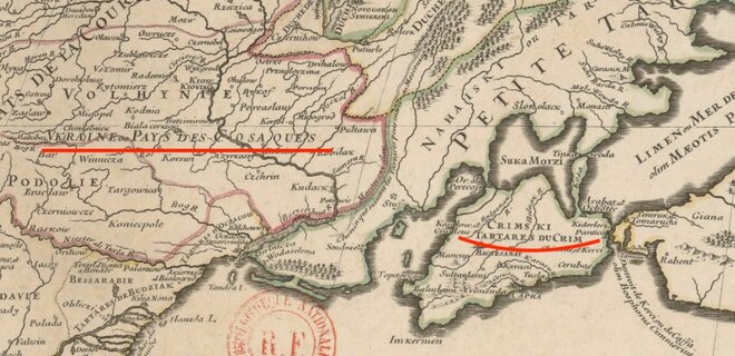
On May 23, the head of the Constitutional Court, Valery Zorkin, showed Russian President Vladimir Putin a 17th-century map drawn up by the French under Louis XIV. Looking at it, neither Zorkin nor Putin "found" Ukraine, since it "did not exist." However, this territory is on the map shown to Putin – as part of the then existing Commonwealth and is signed as "Vkraine ou Pays des Cosaques" ("Ukraine, the land of the Cossacks"). Also on the map, the Crimean Peninsula is not part of the Russian Empire, and is listed as Crimski tartares du Crim – Crimean Tatars of Crimea.
Blogger Yigal Levin remarked that this map is in the public domain at the French online library Gallica , and "everyone can see it".

The journalists also noticed that Belgorod is marked on the map as Ocraina.